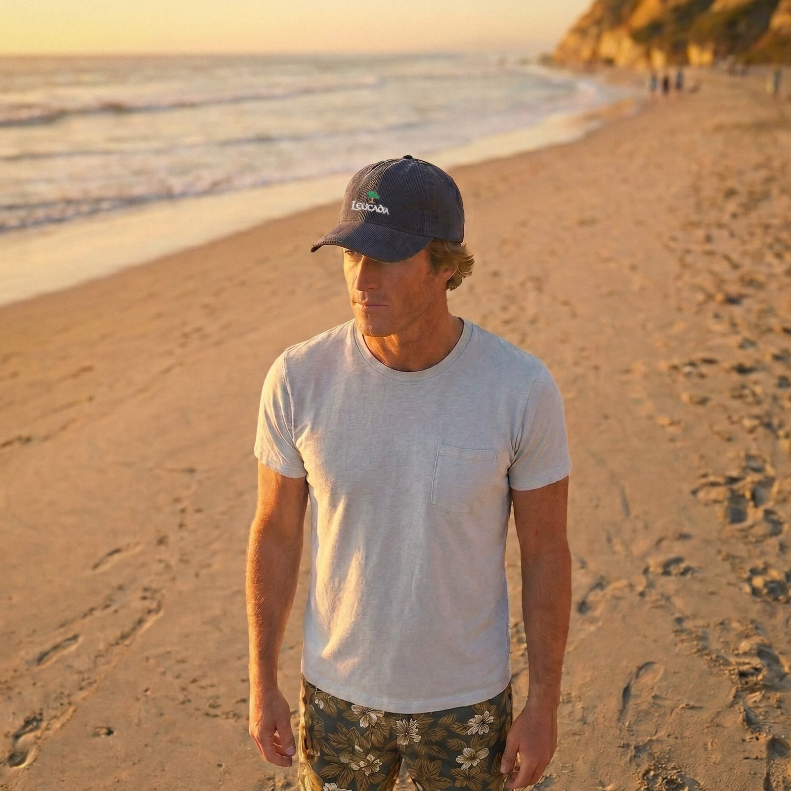
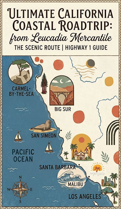
A guide to the classic California coastal drive — from Los Angeles north through Malibu, Santa Barbara, and the Central Coast to Big Sur. Where to stop, what to eat, and what to know before you go.
This California coastal road trip begins in Malibu. The moment you leave the Los Angeles basin and PCH opens up along the Malibu coast, the mountains dropping into the ocean on your right and nothing but Pacific on your left, is when the drive starts.
From there it’s roughly 300 miles to Big Sur, and every one of them earns its reputation. This is a guide to doing it properly.
 Before You Go — Practical Notes
 Before You Go — Practical Notes
Highway 1 through Big Sur is fully open. After a multi-year partial closure from landslides at Regent’s Slide, Caltrans reopened the final section in January 2026. The complete Big Sur coastal drive is connected end to end for the first time in three years. That said, Highway 1 closes without much warning after storms — sometimes for days. Always check current conditions at roads.dot.ca.gov before you leave and again the morning of the Big Sur section. The Big Sur Chamber of Commerce also keeps a reliable, up-to-date road conditions page.
Drive north to south or south to north? Although this guide covers the South to North drive, driving south — starting from San Francisco or Carmel — puts you on the ocean side of the road through the most dramatic sections, meaning pullouts are on the right looking directly down at the water. If you’re coming from Los Angeles and driving north, you’re on the inland side for Big Sur. You’ll still stop constantly to see the view. But if you have the flexibility to fly into San Francisco and drive south, it’s the more scenic direction.
Gas in Big Sur is scarce and expensive. Fill up in San Simeon or Cambria if driving north to Carmel, or in Monterey before heading south into Big Sur. There are very few stations along the 90-mile stretch and the ones that exist charge significantly more than anywhere in California.
Download offline maps. Cell service in Big Sur is genuinely unreliable. Download Google Maps or Apple Maps for the route before leaving.
Book accommodation early. Big Sur fills up months in advance for summer weekends. Carmel and Santa Barbara also book quickly from spring through fall. Sort your accommodation before you start driving.
Best time to go: Late spring (April and May) and fall (September and October). Mild weather, clearer light, smaller crowds. Summer brings morning fog along the coast that sometimes doesn’t lift until midday — atmospheric, but not the light you’re driving for. Winter is dramatic and quiet but brings the highest risk of storm closures on the Big Sur section.
Getting Out of Los Angeles
On a weekday morning, leave before 7am or after 10am to avoid traffic. On weekends, earlier is always better. The PCH through Santa Monica and Pacific Palisades has its own congestion on summer weekends — once you’re past it and into the open Malibu stretch, you’re free. If you prefer to skip the Malibu stretch and get straight up to Santa Barbara area, take the 101 freeway north out of LA for a faster escape.
Malibu — Where the Drive Begins
The moment the road clears the Santa Monica Mountains and opens up along the Malibu coast, the nature of the trip changes. The Pacific appears on your left, wide and blue. The Santa Monica Mountains rise steeply to your right. Traffic thins. The road narrows. You’re driving now.
The stretch from Point Dume to Point Mugu is seventeen miles of uninterrupted coastline — the best section of PCH in Southern California — with the mountains on one side and nothing but open ocean on the other.
El Matador State Beach
El Matador is the most photogenic beach on the Southern California coast. A dramatic cove below sandstone bluffs, reached by a short staircase, with sea stacks rising from the water and small caves carved into the rock at low tide. The parking lot holds about 30 cars and fills fast on weekends — arrive early, or park on PCH and walk in. This is the first stop on the drive that makes you feel like you’ve actually left Los Angeles behind.
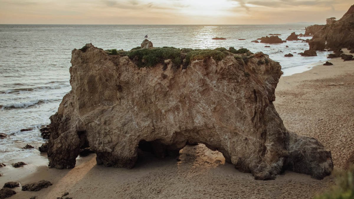
El Matador State Beach
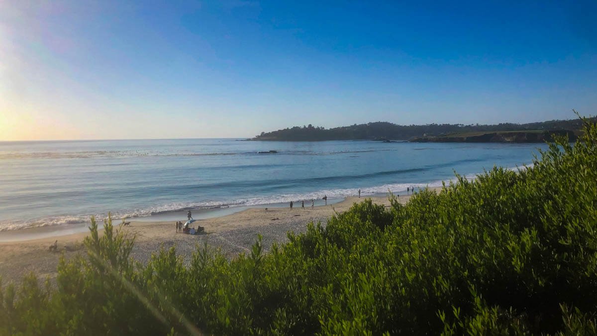
Point Dume
Point Dume is a 203-acre headland forming the northern boundary of Santa Monica Bay. The trail to the top of the bluff gives you a panoramic view of the coastline in both directions — the Santa Monica Bay sweeping south, the open coast stretching north toward Ventura. From December through April, gray whales pass close enough to the point to spot from the overlook. Come at sunset if your timing allows — the view west from the bluff at golden hour is one of the consistently best on this drive.
Neptune’s Net
For food in Malibu, Neptune’s Net at the Ventura County line is the place. A decades-old seafood shack right on PCH with picnic tables outside, fish tacos, cold beer, and the energy of a place that has been feeding road-trippers, surfers, and motorcyclists in exactly the same way since 1956.
A note on the 2025 fires: The Palisades Fire in January 2025 burned through parts of Pacific Palisades and Malibu, and some areas along this stretch of PCH are still in various stages of recovery. El Matador and Point Dume were not significantly affected. PCH is open and the drive is intact — the landscape in some sections just looks different than it did.
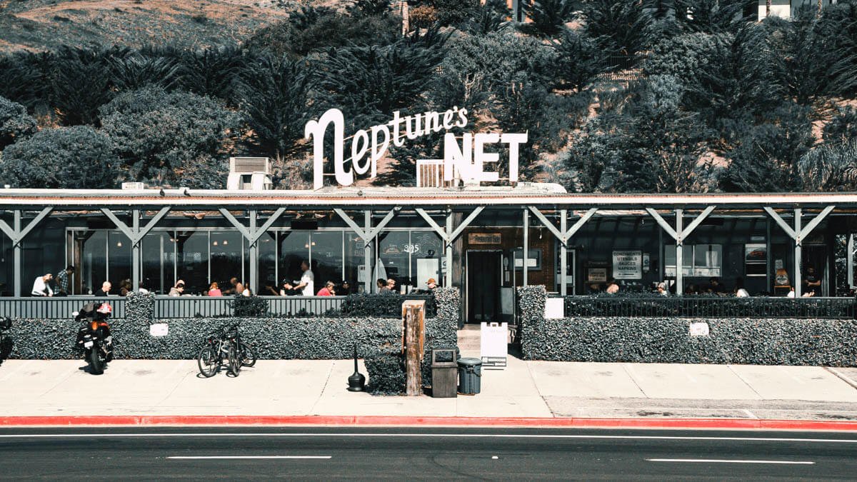
Neptune’s Net in Malibu
Santa Barbara — Stay the Night
~95 miles from LA
Between Malibu and Santa Barbara, PCH moves inland and joins Highway 101 for a stretch through Ventura and Oxnard. This section is not the scenic part — stay on 101 and make time. Santa Barbara is worth saving your energy for.
Wedged between the Santa Ynez Mountains and the Pacific, with red-tile-and-whitewash Spanish Colonial architecture and a walkable downtown that somehow manages not to feel like a theme park, Santa Barbara is one of the most genuinely livable cities on the California coast. Most people doing this drive spend one night here. That’s the right call.
The Funk Zone
Start here. The Funk Zone is a compact warehouse district a few blocks from the beach that has spent the last decade becoming one of the better urban wine destinations in California. Over 20 tasting rooms representing Santa Barbara County’s wine regions — Pinot Noir and Chardonnay from the Santa Ynez Valley, Syrah from the Santa Rita Hills — concentrated in a few walkable blocks, with good restaurants, street art, and independent shops between them.
The Santa Barbara Wine Collective is the best place to start — flights from all of the county’s growing regions, with a hand-drawn map of the wine appellations on the wall. Pali Wine Co. has a rooftop deck. Municipal Winemakers — known locally as Club Awesome — is the most relaxed room on the trail. Loquita, a Spanish tapas restaurant on the edge of the Funk Zone, is the dinner reservation to make — the gambas al ajillo and the jamón ibérico are the orders.
State Street and the Courthouse
The Santa Barbara County Courthouse, completed in 1929, has a free rooftop observation deck with views across the city’s terracotta rooftops toward the ocean. One of the genuinely beautiful public buildings in California and worth thirty minutes of any morning.
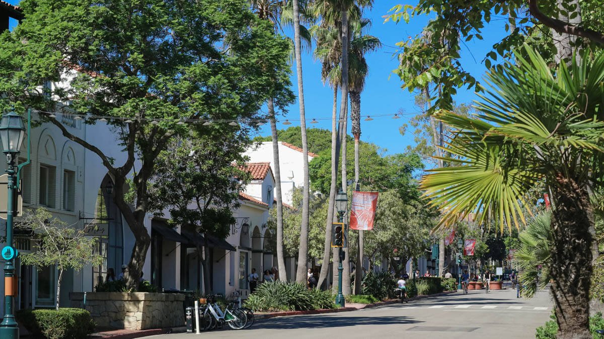
State Street in Downtown Santa Barbara
Stearns Wharf
Stearns Wharf extends into the harbor from Cabrillo Boulevard — the oldest working wooden pier on the West Coast. Walking to the end at sunset, with the mountains lit behind the city and pelicans settled on the pilings, is one of the better sunset views on this stretch of the coast.
Where to stay
Hotel Californian sits in the heart of the Funk Zone with Moorish-influenced architecture and a rooftop pool looking toward the mountains. From around $400/night. Harbor View Inn is the reliable mid-range choice — directly across from Stearns Wharf, ocean views from many rooms, from around $200/night.
Kimpton Canary Inn is 1 block off of State Street and within easy walking distance to the botanical gardens, the Mission, downtown restaurants and shops. From around $400/night.
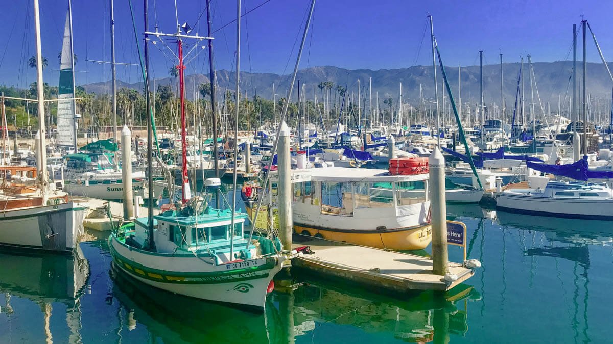
The Harbor in Santa Barbara
The Central Coast — Elephant Seals and Hearst Castle
~220–260 miles from central LA
North of Santa Barbara, Highway 101 carries you through San Luis Obispo and along the coast through Pismo Beach before Highway 1 splits back toward the water near Morro Bay. The towns along this stretch — Pismo, Avila Beach, Cayucos — are good leg-stretch stops, all of them with good seafood and a pace that’s notably slower than anything south of here.
Piedras Blancas Elephant Seal Rookery
Five miles north of San Simeon on Highway 1, hundreds of elephant seals haul out on the beach year-round at the Piedras Blancas rookery. No reservation, no entrance fee — just pull over, walk to the boardwalk overlook, and spend as long as you want watching them. Peak season is January when females arrive to give birth and the bulls compete for territory, but there are animals here in every season. The scale of them — males can reach 16 feet and weigh over two tons — is something most people are not prepared for. This is one of the genuinely surprising wildlife experiences on the California coast and it costs nothing.
Hearst Castle
Hearst Castle at San Simeon is the 165-room hilltop estate built by William Randolph Hearst between 1919 and 1947 — indoor and outdoor pools tiled in gold mosaic, a collection of genuine Roman antiquities installed in the walls, a private zoo that once contained zebras and bears. Guided tours run daily. The Grand Rooms Tour is the standard introduction. It’s either exactly your kind of thing or not at all, and you’ll know before you arrive. Either way, the view from the hilltop back toward the Pacific is worth the drive up regardless of whether you go inside.
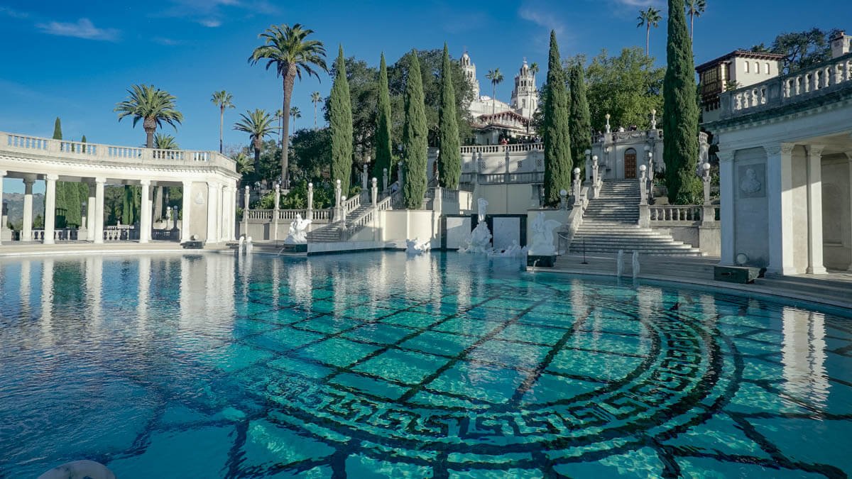
Hearst Castle in San Simeon
Ragged Point — The Gateway
~270 miles from central LA
Ragged Point is where the road gets serious. The gradual coast of San Luis Obispo County ends abruptly here, replaced by the Santa Lucia range falling steeply and immediately into the Pacific. The terrain ahead is different from anything south of this point — the cliffs are higher, the road is narrower, the views are more disorienting in their scale.
Ragged Point Inn has a restaurant and outdoor fire pits overlooking the water. Good lunch stop, or coffee before the more demanding section ahead. The cliffs below the inn drop nearly 400 feet to the ocean. Stand at the edge and look south toward San Simeon on a clear day — that view explains why people plan road trips around this drive.
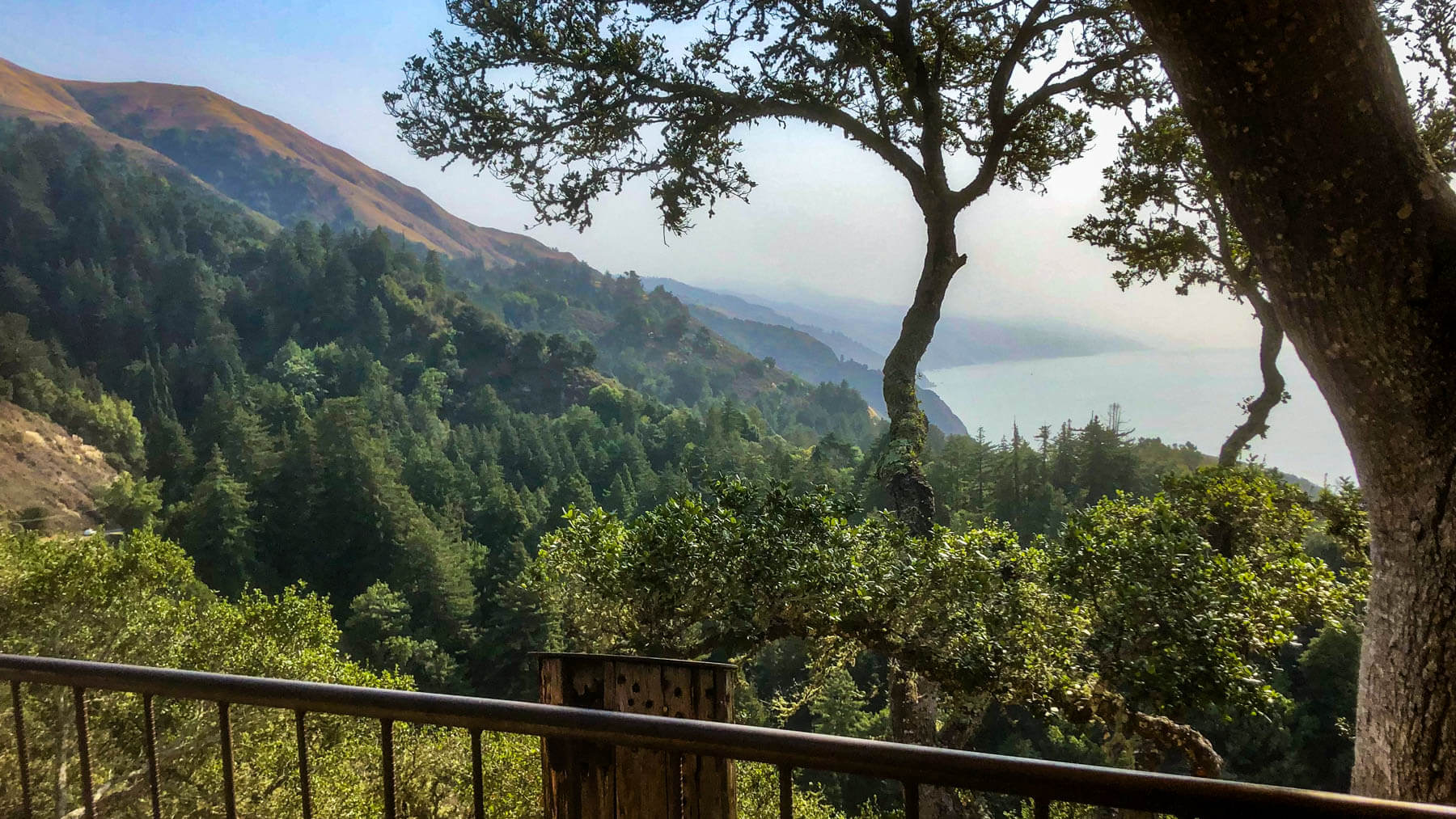
Big Sur
~270–340 miles from central LA
Big Sur is not a town. It’s a region — roughly 90 miles of coastline running north from Ragged Point to Carmel, extending 20 miles inland into the Santa Lucia Mountains. No traffic lights. No grocery stores. No chain restaurants. What there is: 280-foot cliffs dropping into turquoise water, redwood groves a mile from the ocean, waterfalls falling directly onto beach sand, and a density of landscape that makes the road genuinely difficult to drive because you keep stopping.
Highway 1 fully reopened through Big Sur in January 2026 after a multi-year partial closure from landslides. The complete drive is connected end to end. There are minor one-way traffic controls near Big Sur village for ongoing maintenance through summer 2026 — minimal delays. Always check roads.dot.ca.gov for current conditions before the Big Sur section.
Bixby Creek Bridge
Pull off at the Castle Rock Viewpoint just north of the bridge for the photograph that appears in every California road trip article, and deserves to. Built in 1932, Bixby Bridge rises 260 feet above Bixby Creek Canyon and stretches 714 feet across the cliffs. The reality of it is better than the photographs. There’s a dirt road on the north side of the bridge — the Old Coast Road — that gives you an alternate vantage point from across the canyon if the main pullout is crowded. Go early if you want it to yourself.
Hurricane Point
A mile south of Bixby, consistently one of the most dramatic viewpoints on the drive, and consistently skipped by people who don’t know about it. The wind at the overlook lives up to the name. Stop here.
Pfeiffer Beach
Turn west off Highway 1 onto Sycamore Canyon Road — an easy-to-miss unmarked turn — and drive two miles to one of the most unusual beaches on the California coast. Purple-tinged sand from manganese garnet deposits in the surrounding cliffs, a rock arch, waves pushing through the arch at high tide. $15 per vehicle. The road is narrow and the small lot fills early on weekends — arrive by 9am or accept that you’ll be hiking from the highway.
McWay Falls
McWay Falls, part of Julia Pfeiffer Burns State Park, is an 80-foot waterfall falling directly onto a small cove beach, with the Pacific opening up beyond. The overlook trail from the parking area is half a mile round trip. One of the most photographed views in California. The Waterfall Overlook Trail has had intermittent repair closures — check the park website before you go, as the falls are also visible from the highway pullout if the trail is closed. Check trail status here.
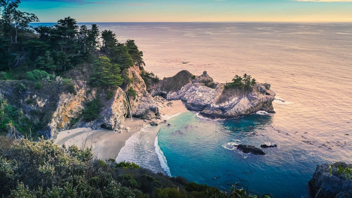
McWay Falls in Big Sur California
Nepenthe
Nepenthe is a restaurant and open terrace perched 800 feet above the ocean that has been serving food and views since 1949. The original cabin was built as a gift for Orson Welles. The Ambrosia Burger is the order. Sit outside. This is the lunch stop on the Big Sur section — the kind of place where you plan to stay an hour and leave three hours later without understanding where the time went. No reservations for parties under five.
Where to stay in Big Sur
Alila Ventana Big Sur is the splurge — luxury villas in the redwoods above the ocean, from around $1,000/night. Glen Oaks Big Sur is the more accessible version — 16 cabins and rooms set among the redwoods on the Big Sur River, from around $250/night, with one of the better restaurants in the area. Big Sur Lodge at Pfeiffer Big Sur State Park is the park accommodation option — simple, well-located, from around $150/night. Campgrounds at Pfeiffer Big Sur and Julia Pfeiffer Burns book months in advance — reserve through ReserveCalifornia as early as possible. There is also camping in the redwoods at Ventana Campground for $80 a night.
Big Sur River Inn deserves its own mention. Opened in 1934 as the Apple Pie Inn — named for the apple pie that was already famous before the PCH was paved — it’s the oldest hotel and restaurant in Big Sur, sitting on the river between Pfeiffer Big Sur State Park and Andrew Molera. The restaurant serves breakfast through dinner daily, with an outdoor deck and a lawn running down to the water. The detail that makes it: you can take a drink from the bar and sit in one of the Adirondack chairs placed directly in the river, feet in the current, redwoods overhead. On Sunday afternoons from May through October, there’s live music on the riverside deck. It’s not a luxury property — 20 rooms, motel-style — but it’s the most characterful stop on the Big Sur section and the one that most feels like it belongs here. From around $200/night.
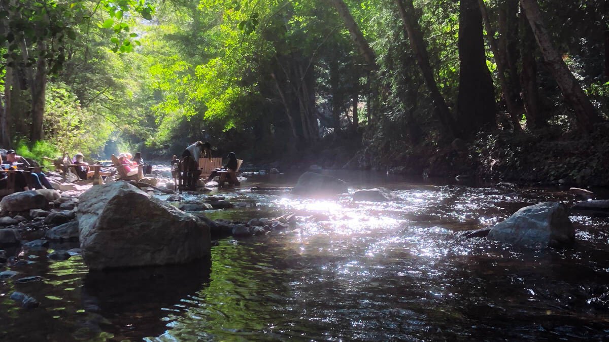
Big Sur River Inn
Carmel-by-the-Sea — The Destination at the Top
~340 miles from central LA
Carmel sits at the northern end of Big Sur, where the drama of the coast settles into something more composed. A small, wealthy village with no street addresses, no stoplights, no chain restaurants — the result of actual civic ordinances dating back decades. It can tip toward precious. The setting saves it every time.
Point Lobos State Natural Reserve, five minutes south of town on Highway 1, is one of the best things to do on the entire drive. Rocky coastal trails, sea otters, harbor seals, sea lions, and cormorant colonies among the most dramatic coves on the coast. The Cypress Grove Trail (0.9 miles) and Bird Island Trail (0.8 miles) are the two walks to do. Only 75 vehicles can enter at once — park on Highway 1 and walk in to skip the wait and the $10 entry fee.
Carmel Beach itself, at the foot of Ocean Avenue, is one of the genuinely beautiful beaches in California — white sand, cypress trees on the bluffs above, the open Pacific beyond. After the intensity of Big Sur, an hour sitting on this beach with a coffee from one of the Ocean Avenue cafes is a reasonable way to decompress before the drive back.
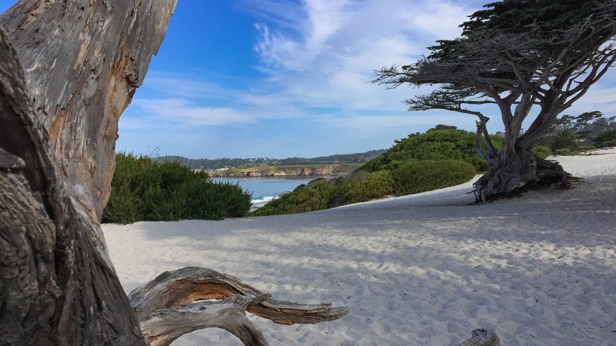
Cypress Trees on Carmel Beach
For dinner, Chez Noir on 5th Avenue is the reservation to make. Chef Jonny Black and his wife Monique opened this seafood-focused bistro in 2022 after careers at Atelier Crenn, Quince, and Pineapple & Pearls — and it earned a Michelin star in its first year, a distinction it has held every year since. The menu changes daily based on what’s available from the Monterey Peninsula’s fishermen, farmers, and foragers — abalone, skate, local halibut, dry-aged fish, housemade charcuterie. Four courses, $165 per person before service charge. The restaurant occupies a charming gray Craftsman house on a quiet village street; the Blacks live on the second floor. Small, intimate, and genuinely one of the best meals you’ll have in California. Open Thursday through Monday from 5pm. Reservations are essential and book out weeks in advance — plan this before you plan the rest of the trip.
La Bicyclette on Dolores Street is a consistent recommendation — a French-Italian bistro with local ingredients and a wine list that leans toward French classics and the Central Coast producers nearby. Reservations recommended on weekends.
For where to stay, here are three distinct character options: the Michelin-starred intimate hotel, the historic grand dame, and the California icon — all of them within walking distance of the village and the beach.
L’Auberge Carmel is the most serious property in town — a Forbes Five Star Relais & Châteaux hotel built in 1929, with 20 individually designed rooms, radiant heated bathroom floors, and Aubergine in the courtyard, which holds two Michelin stars under chef Justin Cogley. Continental breakfast and valet parking are included. From around $700/night. If you’re going to splurge anywhere on this drive, it’s a strong argument for here.
La Playa Hotel is the grand dame alternative — a 75-room property in a 1905 mansion originally built as a gift by an artist to his wife, a member of the Ghirardelli family. A $20 million renovation completed in 2023 updated all rooms while preserving the historic gardens, courtyard, and pool. Complimentary champagne breakfast included. Four minutes’ walk from Carmel Beach. From around $400/night.
Cypress Inn is the mid-range option with the most character — a Mediterranean boutique hotel built in 1929 that was co-owned by Doris Day for over two decades and remains genuinely dog-friendly in a town that takes dog-friendliness seriously. Complimentary breakfast, live jazz at Terry’s Lounge on weekends, and a location a few blocks from Ocean Avenue and the beach. Rooms from around $350/night — not cheap, but Carmel doesn’t really do cheap. If you’re traveling with a dog, this is the easy choice.
Carmel Beach
A Note on the Drive Itself
The PCH between Big Sur and Carmel demands more attention than most drivers give it. The road is narrow in places with no guardrails and real drop-offs. Fog arrives without warning. The temptation to look at the view while driving is constant. Pull over when you want to stop. There’s no shortage of places to pull over. Drive slowly. Give yourself more time than you think you need.
The people who remember this drive most vividly are the ones who didn’t rush it.
More from the Leucadia Mercantile Journal · A weekend in Encinitas · Hiking trails in North County